Monthly Archives: April 2018

Periods of snow or flurries expected today across PEI..

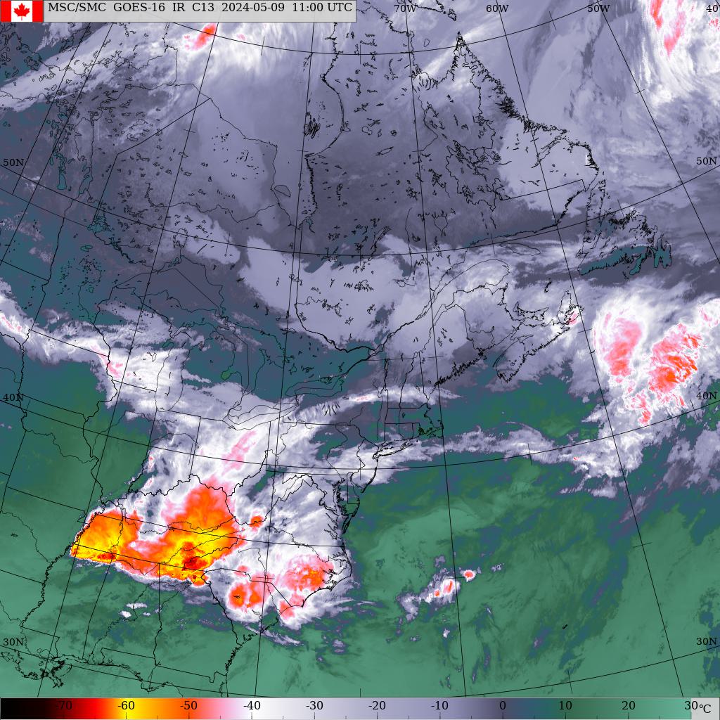
Friday, April 20 9:00am.. Rain developed yesterday evening across the island as a low pressure system approached from the US mid Atlantic coast. The rain changed over to snow just after midnight as temperatures cooled. This weather system is now located just east of Cape Breton Island and will continue to move away to the NE today then stall over Newfoundland for the weekend. This will result in a cloudy, cool brisk NW-N wind off the open waters of cold Gulf. A large area of high pressure will be approaching from the west and should pass just south of the Maritimes on Tuesday morning. The clouds will slowly dissipate Sunday night leading to a warmup on Monday. A warm southerly flow will then develop on Tuesday allowing temps to climb above normal through mid week. Clouds will be on the increase on Wednesday as the next weather system approaches from the Great Lakes. This system is expected to track NE along the St Lawrence River Valley passing north of the region Thursday night resulting in a rain event. So a cloudy cool weekend followed by some sunshine early next week then a warm rain bu Thursday.

Precipitation.. Generally about 3-4 mms rain followed by 3-4 cms snow fell across Kings and Queens counties overnight. Less up west being further from the storm center. Periods of light snow today will taper to flurries later today. Few flurries possible tomorrow. Only slight accumulations as most new snow should melt. Rain is expected to develop Thursday morning and continue into Friday.

Temperatures.. Remaining cool today through the weekend. Slow moderation back to normal for Monday followed by above normal Tuesday through Friday.

Wind... Brisk NW-N wind developing this afternoon and will continue tonight. Light-brisk NW winds over the weekend becoming light W-NW for Monday. Southerlies develop on Tuesday.

Hazards.. Wet/snow/slush covered roads especially in rural less traveled areas. Possible icy areas tonight as temps may drop slightly below freezing.

Watches/warnings.. None for PEI at this time..

Forecast..

Today.. Periods of snow tapering to flurries, increasing NW-N winds, highs +1

Tonight.. Cloudy with chance of flurries, brisk NW-N winds, lows -1

Tomorrow.. Cloudy with chance of flurries, brisk NW winds, highs +2

Sunday.. Sun and cloud, light-brisk NW winds, highs +3

Monday.. Sunny, light W-NW winds, highs +5

Tuesday.. Sunny, increasing SW winds, highs +10

Wednesday.. Sunny start, increasing clouds later in the day, Brisk SW winds, highs +10

Thursday.. Rain, brisk SE winds, highs +10

Friday.. Showers, brisk south winds, highs +10

Rain/snow and cool temps expected across PEI today/tonight/tomorrow.

Thursday, April 19th 10:45am… Good morning.. Been out of the loop weather wise for the past 7 days or so, although I was watching the weather from the beach in Punta Cana. Time to get caught up.. An elongated trough of low pressure oriented east-west is located just north of PEI and will give cloud and a few showers to the island today as it moves NE towards Newfoundland. Another area of low pressure is developing now along the US mid Atlantic coast vicinity Virginia. This system will move NE passing just east of NS overnight tonight then into Newfoundland tomorrow. Unfortunately, PEI will be on the cool side of this system so initially looking at rain developing this evening then changing over to snow as temps cool down. A trough stretching back to the West will maintain cloud and flurries for tomorrow as the system pulls away. Onshore NW-N winds will also continue to give some cloud and flurries into Saturday but improving conditions expected though Sunday as  a large area of high pressure approaches. Unfortunately cool NW winds will continue to keep the temps below normal until the center of high pressure moves to the east of the region later Tuesday but sunshine is expected. Clouds will begin to spread across the region on Wednesday as the next weather system approaches with rain developing Wednesday night.

Precipitation.. Few showers today from the system passing to our north becoming periods of rain later this afternoon as the next system approaches from the SW.  Rain will change over to snow before dawn tomorrow then tapering to flurries tomorrow afternoon. Snowfall amounts in the 5 cm range. Flurries may persist into Saturday. Basically dry conditions then expected Sunday through Tuesday. Rain develops late Wednesday evening and persists through Thursday. Showers continue into Friday.

Temperatures.. Near normal today then cooler air returns tomorrow. A very slow moderation in temperatures begin on Saturday but remaining below normal. Temperatures should be back to normal by Tuesday then above normal for Wednesday through Friday.

Wind.. Light SW-W winds today becoming E-NE tonight increasing to brisk northerly tomorrow. Light-brisk NW winds then continue Saturday through Monday. Warmer SW winds develop on Tuesday.

Hazards.. Wet roads today becoming slush/snow covered by dawn tomorrow especially the less traveled rural roads.

Watches/warnings. None for PEI at this time…

Forecast..

Today.. Cloudy with showers becoming periods of rain, light SW winds, highs 8

Tonight.. Rain changing to snow after midnight, light E-NE winds, lows 1

Tomorrow… Snow tapering to flurries in the afternoon, brisk north winds, highs 1

Saturday.. Cloudy periods, chance of flurries, light NW winds, highs 3

Sunday.. Sun and cloud, light NW winds, highs 4

Monday.. Sun and cloud, light NW winds, highs 6

Tuesday.. Sunny, very light SW winds developing, highs 10

Wednesday.. Sunny start, becoming cloudy with rain towards midnight, light-brisk SW winds, highs 12

Thursday.. Rain, brisk SE winds, highs 12

Friday.. Showers, south winds, highs 12

Sunshine expected next few days across PEI..

Tuesday, April 10th 7:30am.. An area of high pressure passing south of NS will maintain sunshine and light winds across the island today. Clouds will spread across the region overnight tonight as a low pressure system passes well south and east of the Maritimes tomorrow morning. Skies should clear during the day as another ridge of high pressure crosses the island. Clouds will once again spread across the region overnight Wednesday into Thursday morning as a weakening system moves through. Skies will remain cloudy as a more organized low pressure system approaches from Quebec. This system is expected to track northern NB on Friday morning then north of PEI in the afternoon. Mild air will ensure a rain event for the island. The associated cold front sweeps through Friday night then stalls in an east-west fashion across Maine and southern NS. Cool temps will remain anchored across the island through the weekend with this front stalled to our south. This front begins to lift north again on Monday as a low pressure system approaches from the west with snow beginning early. The snow will change over to rain as the milder air returns.

Precipitation.. Fairly dry next few days. Rain should occur Thursday night into Friday morning. Flurries on Monday should change to rain later in the day as temps climb.

Temperatures.. Will be slowly inching up over the next few days peaking on Friday followed by a cold weekend. Another warm-up begins on Monday.

Wind.. Light westerlies today becoming southerly tomorrow which will continue through Friday. Winds then shift back to the NW Friday evening which continue through the weekend.

Hazards.. Fairly quiet next few days.. Rain Thursday night into Friday morning.

Watches/Warnings.. None for PEI at this time..

Forecast..

Today.. Sunny, light west winds, highs +2

Tonight.. Increasing clouds, light south winds, lows -3

Tomorrow.. Sun and cloud, light south winds, highs +4

Thursday.. Sunny start, increasing clouds with rain developing late, light south winds, highs +6

Friday.. Rain ending early then partial clearing, +6

Saturday.. Cloudy, brisk NW winds, highs +1

Sunday.. Cloudy, light-brisk NW Winds, highs -2

Monday.. Cloudy with snow changing to rain, NE winds, highs +2

Sunshine but cold conditions expected today across PEI..

Monday, April 9th 9:00am..  Looks more like mid winter outside today rather than early April! A low pressure system developed off Cape Hatteras over the weekend and intensified while tracking NE towards Newfoundland. This system passed east of NS yesterday evening and is now located over central Newfoundland. The storm dumped significant snow across eastern NS and Cape Breton with 20 cms reported in Sydney and 15-20 through Halifax. Here on PEI, I am still waiting for some measurements to come in but looks like 7 cms reported at the airport. I recorded 3 here in the Bonshaw area while no snow was recorded in Wellington. Skies cleared quickly overnight as the storm pulled away. High pressure will now dominate the region through Thursday but a couple of systems moving through will give some cloud and flurries. The first of which is a storm system passing well east of NS on Wednesday which may spread some cloud and chance of a flurrie. The second system is an upper air disturbance moving across the region on Thursday giving some cloud and chance of a flurrie or shower. On Friday, a low pressure system will track NE along the St Lawrence River valley. This system will usher in milder air resulting in a rain event for Friday. The associated cold front will stall in an east-west fashion somewhere over the Maritimes making for an unsettled weekend. with rain and/or snow depending on exactly where this front lies.

Precipitation… Dry conditions today and tomorrow. Could see a flurrie on Wednesday especially down east. Showers on Thursday becoming periods of rain Friday morning. Rain or snow on the weekend.

Temperatures.. Cold today, a little warmer tomorrow but still below normal. A slow warm up through Wednesday and Thursday. Friday will be the warmest day then below normal again for the weekend.

Wind.. Diminishing NW winds today, light westerly tomorrow then southerly on Wednesday. Brisk southerlies for Thursday and Friday.

Hazards... Drifting snow today will keep rural roads tricky especially in Queens and Kings counties.

Watches/warnings.. None for PEI at this time…

Forecast..

Today.. Clear, brisk NW winds diminishing giving drifting snow. Highs -2

Tonight.. Clear, light W-NW winds, lows -4

Tomorrow.. Sunny, light west winds, highs +2

Wednesday.. Cloudy periods, chance of a flurrie/shower, light south winds, highs +4

Thursday.. Cloudy, showers developing becoming periods of rain later in the day, brisk south winds, highs +5

Friday.. Cloudy with rain ending midday.. brisk south winds, highs +7

Saturday.. Cloudy.. showers/flurries, +2

Sunday.. Cloudy.. showers/flurries, +2

Snow/blowing snow conditions expected across PEI later today..

Sunday, April 8th 7:45am... A weak ridge of high pressure is currently crossing the Maritimes and is giving the calm conditions to the region. Things will change drastically this afternoon…. A low pressure system has developed near Cape Hatteras and will intensify will tracking NE. This storm is expected to near Sable Island late tonight then into Newfoundland tomorrow. Snow and strong northerly winds will effect the island later today into tonight with the strongest impacts across Kings county. Conditions improve during the day om Monday as the storm pulls away. Sunshine should prevail on Tuesday as High pressure slides by to the south of NS.  Another storms system develops off the US Mid Atlantic coast on Tuesday. This system is now expected to stay further offshore limiting it’s effects to only clouds. The next system will be approaching during the day on Thursday with increasing clouds. This system will come out of the Great Lakes passing across northern NB Friday morning. Looks like this will be a rain event for the island with mild temps in place. Clearing conditions late Friday into early Saturday. More rain expected Sunday and Monday..

Precipitation.. Snow will spread across the island early this afternoon ending after midnight tonight. Snowfall amounts will be highest across eastern Kings county where 15-20 cms possible. Lesser amounts towards Charlottetown 10-15 cms dropping off to 5-10 across Summerside  and 2-5 west Prince. Few flurries possible on Wednesday with that system staying well east of NS. Rain Thursday night into Friday. Showers Sunday night through Tuesday.

Temperatures..  Below normal today through Wednesday, at or above normal Thursday and Friday. Below normal for the weekend.

Wind.. Increasing northerlies winds this afternoon peaking after midnight tonight but remaining brisk NW through tomorrow. Theses winds will give extensive blowing and drifting snow especially across Queens and Kings county where the bulk of the snow will fall. Light westerlies on Tuesday becoming southerly on Wednesday.

Hazards.. Accumulating snow beginning this afternoon. Brisk northerly winds will result in extensive blowing and drifting snow.

Watches/warnings.. Winter storm warning in effect for Kings county, Blowing snow advisory in effect for Queens county.

Forecast..

Today.. Snow beginning early this afternoon, increasing north winds, highs +1

Tonight.. Snow, blowing snow, brisk NW-N winds, lows -4

Tomorrow.. Morning flurries, clearing, brisk W-NW winds giving drifting snow, highs -2

Tuesday.. Sunny start, increasing clouds, light west winds, highs +2

Wednesday.. Cloudy with a few flurries, +4

Thursday.. Increasing clouds with rain late +5

Friday.. Rain ending then clearing, +6

Saturday..Sun and cloud, west winds, highs 0

Sunday.. Cloudy, showers/flurries late, highs +2

Old man winter not through with PEI yet..

Saturday, April 7th 8:45am.. An interesting week of weather ahead for PEI with several systems effecting the region. Lets start with the first one. An area of low pressure moved east out of the Great Lakes and is now located near Ottawa. A warm front extending east from the extends right into the Maritimes. The low pressure system will then continue to move east tracking just north of PEI from west to east during the day today. Snow is expected north of the track, rain to its south and a mixture of rain and snow along it’s track. This puts the island in that rain snow region. The further north you are (Alberton/Tignish), then the better chance for all snow. Tonight this system moves east with some partial clearing but that won’t last long as the next low pressure system will be brewing off Cape Hatteras late tonight. This system will intensify and track NE passing east of Sable island late tomorrow night. The exact track is still uncertain but looks like a snow event for eastern regions. This time eastern PEI will see the most snow as they will be closer to the storm track while folks up west may escape with only a flurrie. Now if the storm track shifts westward then the heaviest snows will spread accordingly across the island. Will continue to monitor. Environment Canada has issued a special weather statement regarding this system. High pressure will pass south of the Maritimes for Monday and Tuesday giving some sunshine to the region. The third system will once again develop off Cape Hatteras early Tuesday and track NE also passing east of Sable Island on Wednesday. This system will be very similar to tomorrows event with snowfall confined to eastern sections but again any westerly shift in track will also shift the snow area as well. High pressure in control for Thursday with some sunshine then yest another trough of low pressure crosses the region on Friday. This system looks warmer so looking for a rain event with this one.  So old man winter not through with us yet. Don’t take those snow tires off….

Precipitation.. Snow began just after midnight last night and is now beginning to change over to some rain. About 3 cms snow has been recorded so far. Up west may see a bit more in the way of snow. Total snow should be in the range of 3-5 cms followed by 2-4 mms rain. Dry for tonight into tomorrow morning. Snow redevelops mid afternoon tomorrow ending near noon on Monday. Eastern PEI will receive the most snow with possible 15 cms dropping to 10 across Charlottetown and 5 up west. It must be stressed that these are only early numbers as the models are offering up different solutions as each model takes the storm on a slightly different track.  Generally dry for late Monday through Tuesday then snow develops again on Wednesday. Just how much will once again be determined by storm track off eastern NS. Rain expected on Friday.

Temperatures.. At or below normal for the next week or so. Don’t see any real warmth around yet.

Wind.. Light-brisk westerlies today becoming light SW tomorrow morning shifting to northerly tomorrow evening. Brisk westerly on Monday diminishing to light on Tuesday.

Hazards.. Accumulating snows today then again tomorrow afternoon through evening/overnight.

Watches/warnings... A special weather statement in effect for PEI regarding tomorrow afternoon’s system.

Forecast..

Today.. Snow changing to rain. Could stay snow longer up west, brisk west winds, highs +4

Tonight.. showers/flurries ending then partial clearing, very light NE winds, lows -2

Tomorrow.. Snow developing in the afternoon, light SW-W winds, highs +1

Monday.. Clearing, Brisk west winds, highs -1

Tuesday.. Increasing clouds, light west winds, highs +2

Wednesday.. Possible snow.. +2

Thursday.. Sun and cloud, +4

Friday.. Rain +4

Snow redeveloping tonight across PEI..

Friday, April 6th 6:50am.. A ridge of high pressure approaching from the SW will allow the skies to clear later this morning. This feature actually by to the south of the Maritimes today. Skies will begin to cloud over this evening as a low pressure system approaches from the Great Lakes. This low will move across northern NB tonight then continuing moving east to lie just north of PEI near noon tomorrow with a snow-rain event expected. A frontal system will then become stalled just off the Atlantic coast of NS on Saturday. Low pressure will develop off the US mid Atlantic coast on Sunday and ripple NE along this stalled frontal boundary passing east of NS Sunday night. The various computer models have actually come out of agreement with the track or how close this low gets to NS. Will continue to watch this. Another noreaster was expected to form on Tuesday and track towards NS for Tuesday night. Models have now shifted this storm as well further east. So a high degree of uncertainty over the next few days  with respect to 2 east coast systems..

Precipitation.. Flurries should end this morning.. Snow should begin near midnight tonight changing to rain bear dawn on Saturday ending near noon. Snowfall amounts near 5 cms. Snow begins again early afternoon on Sunday ending by evening with another 5 cms possible. Rain and/or snow on Wednesday/Thursday.

Temperatures.. At or slightly below normal  for the next 7 days..

Wind... Brisk Westerly today becoming SW tomorrow, northerlies on Sunday, NW on Monday.

Hazards.. Snow beginning tonight.

Watches/warnings.. None for PEI at this time..

Forecast..

Today.. Flurries ending then clearing, brisk west winds, highs 0

Tonight..Clouding over with snow developing near midnight then changing to rain near dawn. Brisk SW winds, lows -2

Tomorrow.. Rain ending near noon, light-brisk SW winds, highs 4

Sunday.. Cloudy, snow developing near noon, increasing NE winds, highs 1

Monday.. Sun and cloud, NW winds, highs -1

Tuesday.. Sun and cloud, W-SW winds, highs +1

Wednesday..  Showers developing +2

Thursday.. Rain ending.. +5

Cooler conditions expected across PEI next few days..

Thursday, April 5th 6:50am.. A low pressure system moved NE out of the Great Lakes area yesterday and is now located in the northern Gulf. Snow began across the island yesterday morning and changed to rain as temps climbed. There was even some thunderstorm activity late yesterday afternoon. The associated cold front then swept across the island during the overnight hours which ushered in the cooler air. A ridge of high pressure located in the Great Lakes region now will move SE cresting over the island during the day tomorrow. Another area of low pressure will approach from the west on Friday tracking right across the Maritimes to be located over PEI by Saturday morning. This system will bring a snow/rain event to the island beginning near midnight  Friday night. As mentioned,  this system tracks right across PEI Saturday morning with some accumulating snow especially for Prince County. Sunday and Monday remain unsettled as a frontal trough gets stalled just off the Atlantic coast of NS. A ridge of high pressure passing through the region late Monday into Tuesday will allow for some sunshine. All eyes then shift once again to the US east coast as a storm system develops near Cape Hatteras early Tuesday morning. This intensifying system will then track NE to be located near Yarmouth Tuesday night/Wednesday morning then near Sydney Wednesday afternoon. This particular track would keep the island in the cooler air and models at hinting at a possible significant snow event. This is still of course in the long range and will most definitely  change over the upcoming days as we get closer to the event day.

Precipitation.. The rain is basically over but can’t rule out a stray flurrie until noon. Tomorrow should be dry then snow develops Friday mid evening and may become mixed with or change over to rain during the overnight hours then back to snow Saturday morning as the system pulls away to the east. Snowfall amounts in the 2-4 cm range. Sunday remains unsettled with a chance of a flurrie. Gradual improvement on Monday. Snow begins late Tuesday evening and continues all day Wednesday with significant amounts possible.

Temperatures.. Basically below normal through at least Thursday of next week.

Wind.. Brisk SW-W winds today through Saturday dropping off to light/calm Saturday night. Increasing NW winds on Sunday then westerlies on Monday.

Hazards.. Wet roads may become icy with the lower temps today and tonight.

Watches/warnings.. None for PEI at this time..

Forecast..

Today..Cloudy with flurries, brisk SW winds, temps steady near 0

Tonight.. Cloudy with chance of a flurrie, light-brisk SW-W winds, lows -6

Tomorrow.. Sun and cloud, becoming cloudy with snow after midnight brisk west winds, highs 0

Saturday.. Snow/rain, brisk west winds, highs +2

Sunday.. Cloudy, showers/flurries, light north winds, highs +1

Monday.. Sun and cloud, light west winds, highs +1

Tuesday.. Sunny start becoming cloudy with snow late +2

Wednesday.. Possible snow/wind event..


Snow changing to rain event expected today for PEI..

Wednesday, April 4th 7:15am.. A low pressure system in southern Ontario this morning is moving NE and should located near Anticosti Island overnight tonight. A warm front is extending eastward from the low has spread the cloud and snow/rain/freezing rain across the Maritimes this morning. This front should lift north of the region this afternoon allowing temps to climb well above normal through the evening hours today. The associated cold front extends southward from the low and will sweep across the island overnight tonight. This frontal passage will usher in cooler dryer air for Thursday as high pressure passes by well to the south. Clouds will be on the increase on Friday as a weak area of low pressure approaches with snow developing in the evening. The system itself will move right across the Maritimes from west to east during the overnight hours Friday night. The remainder of the weekend remains cloudy and unsettled with a frontal trough stalled just off the Atlantic coast of NS. High pressure slides through on Monday. Things looking interesting early next week with the approach of on intensifying noreaster approaches the Maritimes. Still too far out to go into any details but will need to keep  an eye on this.

Precipitation..Snow has spread across the island and will change over to rain later this morning as temps climb. The change over will take longer to happen up west where it will stay cooler a bit longer. Snowfall amounts possible in the 2-4 cm range followed by about 10 mm rain. The rain should end just after midnight tonight followed by a few flurries tomorrow. Snow redevelops Friday evening ending near noon on Saturday which could give 5-10 cms but this could be rain if the low tracks a little further north. Will have to keep an eye on this and will have a better idea tomorrow. Flurries continue into Sunday with the stalled frontal system located off NS. Monday into early Tuesday looking dry then that noreaster begins to approach later Tuesday. Details on this still unclear.

Temperatures.. Turning mild this afternoon with temps peaking near midnight tonight in the 10/12 range. Temps will then cool off dropping to 3 by dawn tomorrow then staying slightly below normal through the weekend. Temps remain at or slightly below normal into next week.

Wind.. Increasing SE winds today shifting to SW this evening then westerly on Friday.Light and variable winds over the weekend. NW winds on Monday.

Thunderstorms.. Chance of a rumble or two later today.

Hazards.. Wet snow this morning followed by rain until about midnight.

Watches/warnings.. None for PEI at this time.

Forecast..

Today.. Snow early changing to rain, increasing SE winds, temps climbing to 6 by suppertime.

Tonight.. Rain ending near midnight, chance of a thundershower, brisk South winds, temps climbing to 10 by midnight then falling to 3 by dawn tomorrow.

Tomorrow..Cloudy with a few flurries ending later in the day, brisk SW-W winds, highs 2

Friday.. Increasing clouds with snow late, brisk west winds, highs 2

Saturday.. Snow ending then cloudy with flurries, light winds, highs 2

Sunday.. Cloudy with a few flurries/showers, light winds, highs 2

Monday..Sun and cloud, NW winds, highs 0

Tuesday.. Increasing clouds with snow late, 1

Wednesday.. Snow/rain ??

Snow/rain event expected for PEI beginning late tonight..

Tuesday, April 3rd 7:00am.. An area of high pressure centered near Cape Cod this morning continues to slide eastward passing south of NS today. Clouds will invade the region over the next few hours in advance of a warm front approaching from the SW with snow developing near dawn tomorrow. The snow will change over to rain before noon on Wednesday with temps soaring into the double digits by Wednesday evening.  The associated low pressure system will be moving NE out of the Great Lakes and tracking across northern NB Overnight Wednesday night into Thursday morning. The cold front will then sweep eastward across the island after midnight Wednesday night bringing an end to the very mild air. Skies will clear on Thursday as a ridge of high pressure approaches from the west cresting over the island near noon on Friday. Skies will once again cloud over as the next weather system approaches from the west. This system will also track across northern NB Friday night into early Saturday morning giving another snow- rain-snow event for the island. Colder air moving in behind this system Saturday morning will change the rain back to snow near dawn Saturday morning then ending by noon. Clouds remain through the remainder of the weekend.

Precipitation.. Snow develops near dawn tomorrow changing over to rain by noon tapering to showers by evening. Snowfall amounts in the 2-4 cms range before the change over followed by 10-15 mms rain. Dry for Thursday and most of Friday. Sow begins again late Friday changing to rain after midnight then back to snow before dawn on Saturday tapering to flurries in the afternoon. Snowfall amounts in the 5 cm range. Flurries for Sunday.

Temperatures.. Normal today, well above normal tomorrow then at or slightly below normal for the remainder of the period.

Wind.. Light westerly today, increasing SE winds tomorrow, brisk SW winds on Thursday, brisk westerlies on Friday then southwesterlies again on Saturday. Light SW winds on Sunday and Monday.

Hazards.. Snow tonight, rain and snow melt tomorrow. Repeat that again Friday night into Saturday.

Watches/warnings.. None for PEI at this time…

Forecast..

Today.. Sunny start, increasing clouds, light west winds, highs +5

Tonight.. Snow developing after midnight, light south winds, lows 0

Tomorrow.. Snow to start changing to rain before noon, increasing South winds, temps rising to 9 by late evening.

Thursday.. Sun and cloud, brisk SW winds, highs +3

Friday.. Sunny start, increasing clouds with snow late, increasing southerly winds, highs +4

Saturday.. Rain changing to snow then ending through the afternoon, +4

Sunday.. Flurries, +2

Monday.. Sunny..