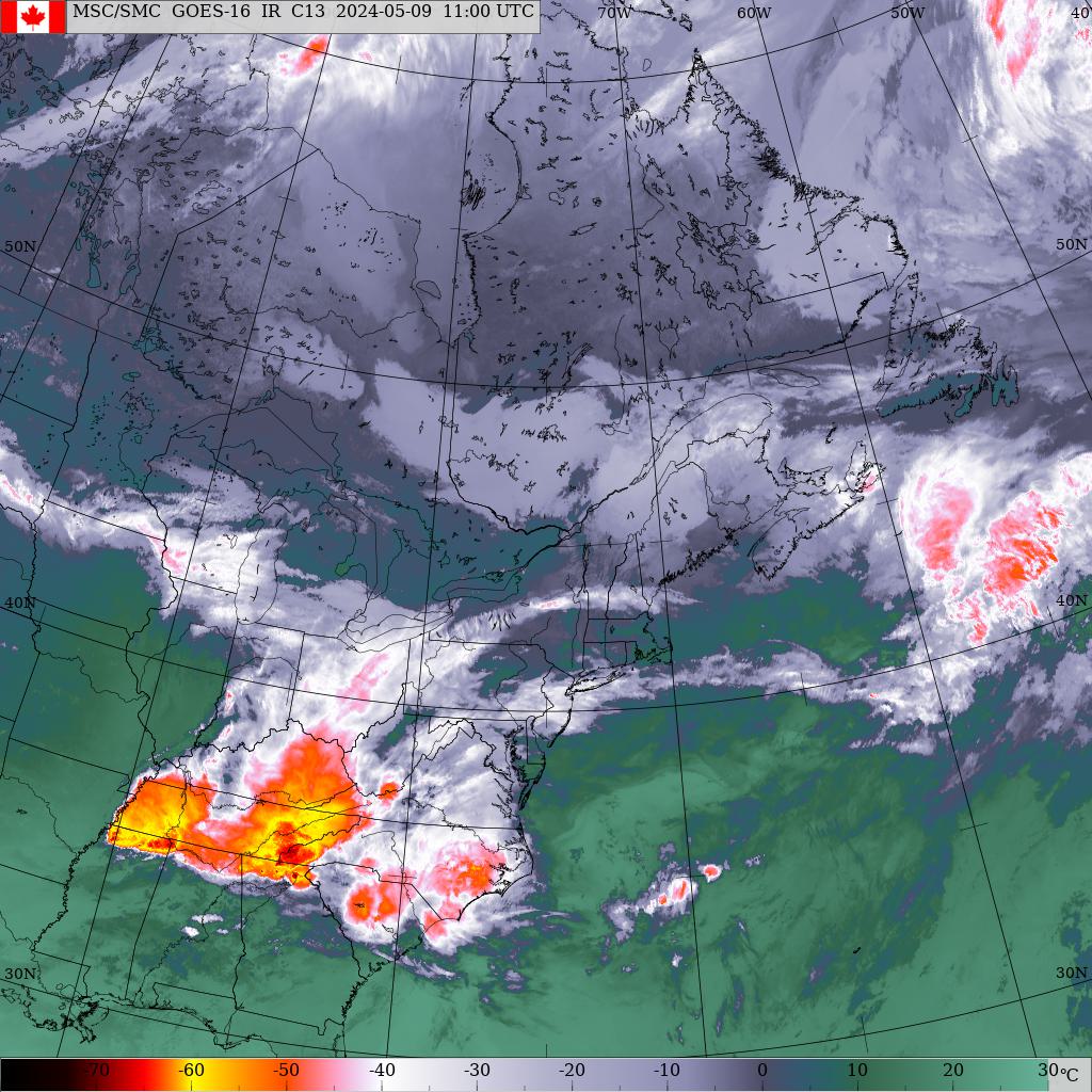
Sunday, Sept 3rd, 8:00am... An area of high pressure located just east of NS this morning will continue to drift away to the east today, meanwhile a low pressure system has developed along the US mid Atlantic coast vicinity New Jersey. This system developed from the left over energy from “Harvey” and will continue to intensify as it moves up the coast today. The storm is expected to move across NB tomorrow morning with rain and wind. High pressure briefly builds in behind this low Monday evening with some clearing but clouds will then invade from the west on Tuesday as a cold front approaches. This cold front is then expected to stall over the Maritimes through the end of the week. Tropical moisture will stream NE along this front setting the stage for a rain event on Thursday.
Precipitation.. Dry today, rain spreads across the island just after midnight tonight ending before noon tomorrow giving about 10mm across central Queens. A little more up west and a little less down east. Dry for Monday afternoon through Tuesday evening. Showers develop late Tuesday and continue through the weekend. There will be some tropical moisture streaming northward which will give a rain event for Thursday into Friday just not sure where this will set up.
Temperatures. A chilly start to the day today. Near normal today and tomorrow followed by a couple days of above normal for Tuesday and Wednesday then back to normal again.
Wind.. Gonna get windy tonight. Light south winds now will increase to brisk this evening then brisk-strong toward dawn tomorrow. These brisk SW winds will continue into Tuesday and actually through Thursday finally shifting and diminishing to light northerlies on Friday.
Thunderstorms.. Can’t rule out a rumble overnight tonight.
Tropical systems.. The remnants of “Harvey” will merge with a developing system along the mid Atlantic coast of US today and move across NB tomorrow morning with some rain and gusty south winds. Hurricane “Irma” continues to churn away in the central Tropical Atlantic. The system is basically moving west and will approach the northern Leeward island in about 60 hrs or Tuesday night. The system is then expected to curve NW passing north of the Dominican Republic Wednesday night then towards the Bahamas for Friday morning. This is by no means the track the storm will take but is the forecast track with information available at this time. This track will surely change as we go forward.
Hazards.. Wet driving conditions in rain beginning near midnight tonight.
Watches/warnings.. None for PEI at this time..
Forecast..
Today… Fog patches lifting then increasing clouds, light south winds, highs 19
Tonight.. Rain developing just after midnight, light-brisk south winds, lows 14
Tomorrow.. Rain ending before noon then clearing, brisk-strong SW winds, highs 19
Tuesday.. Sunny start becoming cloudy, brisk SW winds, highs 25
Wednesday.. Cloudy with chance of showers, brisk SW winds, highs 26
Thursday… Rain possibly heavy, brisk SW winds, highs 20
Friday.. Showers, brisk North winds, highs 20
Saturday.. Cloud and showers, north winds, highs 19


